










1 / 10 Questions
0 Points

Which Breakfast Cereal Was Born From A Sanitarium Kitchen Accident?

Cheerios

Rice Krispies

Corn Flakes

Shredded Wheat

Points won
0
Correct score
0%

More Quizzes

More Articles

Natural Events That Reshaped Landscapes

Natural Events That Reshaped Landscapes

⏱️ 5 min read

Throughout Earth's 4.5-billion-year history, powerful natural forces have continuously sculpted and transformed the planet's surface. From explosive volcanic eruptions to massive glacial movements, these dramatic events have created the diverse landscapes we see today. Understanding how these natural phenomena reshape our world provides insight into the dynamic processes that continue to modify Earth's geography and influence human civilization.

Volcanic Eruptions and Land Formation

Volcanic activity stands as one of the most transformative forces in landscape modification. When molten rock from beneath Earth's crust breaks through to the surface, it can fundamentally alter terrain within hours or gradually build new landmasses over millennia. The 1980 eruption of Mount St. Helens in Washington State demonstrated the immediate and catastrophic impact volcanoes can have, reducing the mountain's elevation by 1,314 feet and devastating 230 square miles of surrounding forest.

On a more constructive scale, volcanic activity created entire island chains. The Hawaiian Islands emerged from the Pacific Ocean floor through repeated eruptions over millions of years, with the Big Island of Hawaii still growing today as Kilauea continues its persistent volcanic activity. Iceland represents another example where volcanic forces literally split a nation between two tectonic plates, creating a landscape of lava fields, geothermal springs, and stark volcanic peaks.

Glacial Movements and Ice Age Transformations

Glaciers have functioned as nature's bulldozers, carving valleys, creating lakes, and reshaping entire continents. During the last Ice Age, which ended approximately 11,700 years ago, massive ice sheets up to two miles thick covered much of North America, Europe, and Asia. As these frozen behemoths advanced and retreated, they ground down mountains, transported enormous boulders hundreds of miles from their origins, and carved the distinctive U-shaped valleys visible in places like Yosemite National Park.

The Great Lakes of North America owe their existence to glacial activity. As ice sheets retreated, they left behind massive depressions that filled with meltwater, creating the largest group of freshwater lakes on Earth. Similarly, the fjords of Norway, New Zealand, and Chile showcase the dramatic landscapes created when glaciers carved deep channels through coastal mountains, later flooded by rising sea levels.

Earthquakes and Tectonic Shifts

The movement of tectonic plates generates earthquakes that can instantly alter landscapes. The 1906 San Francisco earthquake revealed the power of the San Andreas Fault, shifting ground up to 20 feet in some locations. More recently, the 2011 Tohoku earthquake in Japan moved the main island of Honshu approximately 8 feet eastward and shifted Earth's axis by nearly 4 inches.

Over longer timescales, tectonic forces have created Earth's most impressive mountain ranges. The Himalayas continue rising as the Indian subcontinent collides with Asia, growing approximately 5 millimeters annually. The Andes, formed by the subduction of oceanic crust beneath the South American plate, stretch 4,300 miles along the continent's western edge, demonstrating how plate tectonics shape entire regions.

Catastrophic Flooding Events

Massive floods have repeatedly reshaped landscapes throughout geological history. The Missoula Floods, occurring between 15,000 and 13,000 years ago, rank among the most dramatic. When ice dams containing glacial Lake Missoula repeatedly failed, they released water volumes equivalent to the combined flow of all rivers on Earth, carving the distinctive channeled scablands of eastern Washington and creating features like the Columbia River Gorge.

River floods continue shaping landscapes today, though usually more gradually. The annual flooding of the Nile River, before modern dam construction, deposited nutrient-rich sediment across Egypt's farmlands for thousands of years, creating the fertile valley that supported ancient civilizations. The Mississippi River has shifted its course dramatically throughout history, abandoning old channels and creating new ones, leaving behind oxbow lakes and transforming coastal Louisiana.

Coastal Erosion and Sediment Deposition

The relentless action of waves and currents continuously modifies coastlines worldwide. The White Cliffs of Dover lose approximately one centimeter of chalk annually to erosion, while entire communities along Alaska's Arctic coast face relocation as permafrost melts and waves consume the land at accelerating rates.

Conversely, sediment deposition builds new land. The Ganges-Brahmaputra Delta, the world's largest river delta, covers 41,000 square miles across Bangladesh and India, continuously growing as rivers deposit sediment washed from the Himalayas. Similarly, the Mississippi River Delta has extended Louisiana's coastline into the Gulf of Mexico, though human interference has recently complicated this natural process.

Meteor Impacts and Extraterrestrial Influences

Though rare, meteor impacts have dramatically reshaped Earth's surface. The Chicxulub impact 66 million years ago, which contributed to dinosaur extinction, created a crater over 90 miles wide on Mexico's Yucatan Peninsula. Meteor Crater in Arizona, formed approximately 50,000 years ago, remains one of Earth's best-preserved impact sites, measuring nearly a mile across and 570 feet deep.

The Ongoing Process of Landscape Evolution

These natural events demonstrate that Earth's landscapes remain in constant flux. While some changes occur instantaneously through catastrophic events, others unfold over geological timescales. Understanding these processes helps scientists predict future changes, assess natural hazards, and appreciate the dynamic planet we inhabit. As climate change accelerates certain natural processes, monitoring and understanding landscape-altering events becomes increasingly crucial for human adaptation and environmental stewardship.
How to Cross a River Safely

How to Cross a River Safely

⏱️ 5 min read

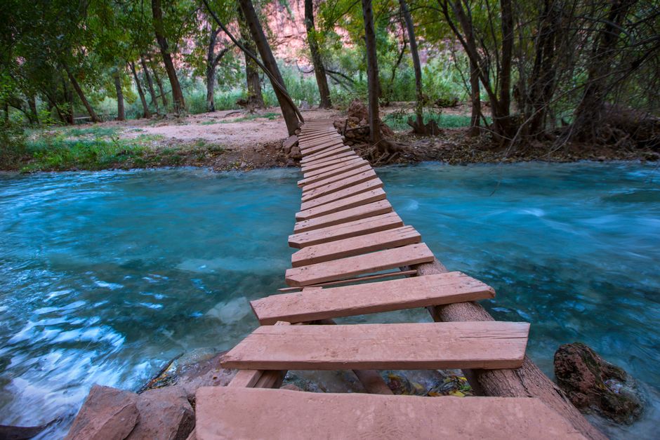
River crossings represent one of the most dangerous challenges encountered in wilderness survival situations. Fast-moving water, hidden obstacles, and cold temperatures can quickly turn a seemingly simple crossing into a life-threatening scenario. Understanding proper techniques and assessing conditions before attempting to cross can mean the difference between reaching safety and becoming another statistic. Every year, experienced hikers and outdoor enthusiasts lose their lives attempting river crossings, making this skill essential for anyone venturing into remote areas.

Assessing River Conditions Before Crossing

Before attempting any river crossing, conducting a thorough assessment of the conditions is absolutely critical. The appearance of calm water from a distance can be deceiving, hiding dangerous currents, drop-offs, and obstacles beneath the surface.

First, observe the water color and clarity. Glacial melt produces milky, opaque water that makes it impossible to see underwater hazards. Clear water allows for better visibility but doesn't necessarily indicate safer conditions. Brown or muddy water often indicates recent rainfall and potentially dangerous flood conditions upstream.

Water depth and flow speed determine the difficulty and danger level of any crossing. Water moving faster than walking pace poses significant risk, as current strength increases exponentially with speed. Knee-deep water moving at just five miles per hour can sweep an adult off their feet. Thigh-deep water at that speed becomes nearly impossible to cross safely.

Take time to walk upstream and downstream to scout for better crossing locations. Look for areas where the river widens and becomes shallower, as water spreads out in these sections, reducing depth and current speed. Avoid narrow channels where water accelerates, and steer clear of areas immediately above or below waterfalls, rapids, or large boulders that create turbulence.

Timing Your River Crossing

The time of day significantly impacts river conditions, particularly in mountainous regions. Snowmelt and glacier-fed rivers typically run lowest in early morning after cold overnight temperatures reduce melting. Water levels can rise dramatically throughout the day as temperatures increase, transforming a manageable crossing into an impossible one.

Rivers swollen by recent rainfall require patience. Waiting 12 to 24 hours after heavy rain allows water levels to drop considerably. The temporary delay is far preferable to risking a dangerous crossing in flood conditions.

Seasonal considerations also matter. Spring runoff creates the most dangerous river conditions in many regions, with water levels remaining high for weeks. Late summer and fall typically offer the safest crossing conditions when water levels reach their annual lows.

Essential Equipment and Preparation

Proper preparation and equipment significantly improve crossing safety. Footwear remains crucial—never cross barefoot. River shoes, sandals with ankle straps, or boots that can get wet provide essential protection from sharp rocks and improve traction on slippery surfaces. Some experienced backpackers carry lightweight camp shoes specifically for river crossings.

Unfasten hip belts and sternum straps on backpacks before crossing. In the event of a fall, the ability to quickly shed a heavy pack can prevent drowning. Some experts recommend removing the pack entirely and either floating it across attached to a rope or carrying it with one arm, keeping it free from your body.

A sturdy pole or hiking staff provides critical stability. The pole creates a third point of contact, forming a tripod that dramatically improves balance against current. The pole should be positioned upstream to break the current and provide support.

Proven Crossing Techniques

When entering the water, face upstream or slightly quartered into the current. Moving sideways across the current, rather than trying to walk directly across, reduces resistance and maintains better balance. Take small, shuffling steps without lifting feet completely off the bottom, feeling carefully for secure footing before transferring weight.

The three-point contact method provides maximum stability. With a pole or staff, always maintain three points of contact: two feet and the pole. Move one point at a time—pole, then one foot, then the other foot. Never move two points simultaneously, as this creates instability.

For particularly challenging crossings, groups can employ several proven techniques:

  • The line astern method involves three or more people forming a line facing upstream, with hands on the shoulders or hips of the person ahead, creating a stable chain
  • The tripod method places the strongest person upstream with a person on each side slightly downstream, with arms interlocked around shoulders and backs
  • The wedge formation positions the strongest person at the front point facing upstream, with others forming a V-shape behind for mutual support

Recognizing When Not to Cross

Sound judgment means recognizing when conditions exceed safe limits. Several factors should trigger the decision to find an alternative route or wait for better conditions. Water deeper than mid-thigh poses extreme risk, regardless of current speed. Very cold water, particularly glacial melt, causes rapid loss of muscle control and can induce cold water shock even in summer.

Strong current combined with significant depth creates unacceptable risk. If the current threatens to push you over while standing in knee-deep water at the river's edge, conditions are too dangerous for crossing. The presence of large obstacles like boulders or logs in the current path, along with powerful hydraulics or churning water, indicates hazardous conditions that demand finding an alternative.

Emergency Response and Recovery

Despite careful preparation, accidents can occur. If swept off your feet, immediately shed your pack and assume a defensive swimming position: feet downstream and pointed slightly upward, backside down, head up. Use feet to fend off rocks and obstacles while working toward the nearest bank, typically requiring a diagonal downstream angle to reach shore. Never attempt to stand in fast-moving water above knee depth until reaching calmer conditions near shore, as feet can become trapped between rocks while the current pushes the body downstream, leading to drowning.

After successfully crossing, address wet clothing immediately to prevent hypothermia. Even in moderate weather, wet clothes can cause dangerous heat loss. Change into dry clothes, wring out wet items, and warm up before continuing.