
⏱️ 9 min read
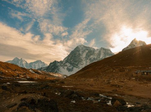
Mount Everest stands taller today than it did when you started reading this sentence. While the difference is microscopic, the world’s highest mountain range continues its relentless upward march at roughly the same pace your fingernails grow. This geological phenomenon has been unfolding for 50 million years, and scientists can now measure the annual changes with remarkable precision.
Quick Facts
- The Himalayas rise approximately 5 millimeters (0.2 inches) each year on average, though rates vary by location.
- The Indian tectonic plate moves northward into the Eurasian plate at about 67 millimeters annually.
- Mount Everest’s official height was revised to 8,848.86 meters in 2020 after new surveys detected growth.
- The collision between India and Asia began roughly 50 million years ago and continues today.
- GPS measurements show some Himalayan peaks growing faster than others due to varying geological conditions.
The Continental Collision That Created a Mountain Range
The story of the Himalayas begins with a massive tectonic event that geologists call the India-Asia collision. Approximately 50 million years ago, the Indian subcontinent, which had broken away from the ancient supercontinent Gondwana, completed its journey across the Tethys Ocean and crashed into the Eurasian landmass. Unlike oceanic-continental collisions where one plate slides beneath the other, this continental-continental collision produced something different: both plates were too buoyant to sink into the mantle, forcing the crust to crumple upward instead.
The Indian plate continues moving northward at approximately 67 millimeters per year, according to GPS measurements and geological surveys. This translates to about 6.7 centimeters annually, or roughly 6.7 meters every century. However, not all of this movement converts to vertical growth—much of the energy dissipates through horizontal compression, crustal thickening, earthquakes, and the formation of thrust faults that characterize the Himalayan region. The actual vertical uplift averages around 5 millimeters yearly, though this figure masks significant regional variation.
Modern Measurement Techniques Reveal Precise Growth Rates
Scientists employ multiple sophisticated methods to track Himalayan growth with unprecedented accuracy. GPS stations installed across the mountain range continuously monitor position changes down to the millimeter. These stations, part of networks like the Plate Boundary Observatory and various national geodetic programs, transmit data revealing both horizontal and vertical crustal movement.
Satellite-based radar interferometry, known as InSAR (Interferometric Synthetic Aperture Radar), provides another crucial measurement tool. This technology compares radar images taken at different times to detect ground deformation with millimeter-level precision. Following Nepal’s devastating 2015 earthquake, InSAR measurements revealed that some areas near Kathmandu subsided by up to 1.5 meters, while surrounding regions experienced uplift—demonstrating how seismic events temporarily affect the long-term growth pattern.
Traditional surveying methods still contribute valuable data. The 2020 announcement that Mount Everest’s height had been recalculated to 8,848.86 meters (29,031.7 feet)—86 centimeters higher than the previous Chinese measurement—resulted from a joint Nepal-China survey using GPS, leveling instruments, and trigonometry. This collaborative effort represented the most accurate Everest measurement to date, accounting for snow depth and geodetic calculations.
Why Growth Rates Vary Across the Range
The Himalayas don’t grow uniformly along their 2,400-kilometer arc from Pakistan to Myanmar. The central and eastern sections generally experience faster uplift than the western portions, with some peaks in the Everest region rising at rates approaching 10 millimeters annually. These variations stem from differences in crustal composition, fault geometry, and the angle at which the Indian plate underthrusts the Eurasian plate.
Nanga Parbat in Pakistan presents a particularly interesting case. This 8,126-meter peak experiences some of the fastest uplift rates in the entire range—up to 7 millimeters per year according to some studies. The mountain sits at the western anchor of the Himalayas where the Indian plate takes a sharp bend, creating intense localized stress. Simultaneously, the Indus River erodes material from Nanga Parbat’s slopes, and paradoxically, this erosion may actually accelerate uplift through a process called isostatic rebound—as weight is removed from the surface, deeper crustal material rises like a cork released underwater.
The phenomenon known as “tectonic aneurysm” explains some extreme uplift zones. In certain locations, concentrated erosion by rivers cutting through the range removes surface material so rapidly that it triggers additional uplift. The Tsangpo Gorge in Tibet, where the Yarlung Tsangpo River (which becomes the Brahmaputra) cuts through the eastern Himalayas, demonstrates this feedback loop. Here, uplift rates can exceed 10 millimeters annually in response to both tectonic forces and erosional unloading.
Erosion Versus Uplift: The Constant Battle
While tectonic forces push the Himalayas upward, erosion simultaneously wears them down. The monsoon climate delivers enormous precipitation to the southern slopes—some areas receive over 4,000 millimeters of annual rainfall. This water powers rivers that carry away an estimated 1 billion tons of sediment from the Himalayas each year, eventually depositing it in the Bay of Bengal and the Arabian Sea.
The Ganges-Brahmaputra Delta, one of Earth’s largest river deltas, consists almost entirely of Himalayan sediment accumulated over millions of years. The sheer volume of material removed from the mountains is staggering, yet the range continues growing because tectonic uplift outpaces erosion in most locations. Scientists estimate that without erosion, the Himalayas might be twice their current height, though this remains speculative since erosion and tectonics interact in complex ways.
Glacial erosion adds another dimension to this process. While Himalayan glaciers have been retreating due to climate change, they historically carved dramatic valleys and peaks. Glaciers act like massive conveyor belts, plucking rocks from mountainsides and grinding valleys deeper. Some researchers argue that rapid erosion during ice ages may have actually accelerated crustal uplift through isostatic compensation, creating a climate-tectonics feedback loop that influenced both mountain building and monsoon patterns.
Earthquake Evidence of Ongoing Mountain Building
The earthquakes that regularly shake the Himalayan region provide dramatic evidence that mountain building remains active. The April 2015 Gorkha earthquake in Nepal, measuring 7.8 on the Richter scale, killed nearly 9,000 people and released energy equivalent to hundreds of nuclear bombs. This earthquake resulted directly from the ongoing collision between the Indian and Eurasian plates.
GPS measurements following the 2015 quake revealed that Kathmandu moved three meters southward in a matter of seconds, while the Langtang region north of Kathmandu rose by up to one meter. These sudden movements represent years or decades of accumulated tectonic stress being released instantaneously. Scientists estimate that the Main Himalayan Thrust—the massive fault system beneath the range—accumulates elastic strain at approximately 20 millimeters annually, periodically releasing this energy through major earthquakes.
Historical records and geological evidence suggest that great earthquakes (magnitude 8 or higher) strike the Himalayas roughly every 75 to 100 years on average, though intervals vary significantly by region. The 1934 Bihar-Nepal earthquake and the 1950 Assam earthquake both exceeded magnitude 8, demonstrating the immense seismic potential of this collision zone. Each major earthquake represents a sudden adjustment in the ongoing process of mountain building, with some areas experiencing sudden uplift while others subside.
Future Projections and Long-Term Outlook
The collision between India and Asia shows no signs of stopping. Computer models suggest the Indian plate will continue pushing northward for tens of millions of years, though the rate may gradually slow. Some projections indicate that the Himalayas could gain another 1,000 meters of elevation over the next 10 million years if current rates persist, though erosion, climate change, and variations in tectonic stress make such predictions highly uncertain.
Climate change introduces new variables into the mountain-building equation. Retreating glaciers alter erosion patterns and change the weight distribution on the Earth’s crust. Some scientists hypothesize that rapid glacier loss could trigger increased seismic activity through isostatic adjustment, though this remains debated. The reduction in ice mass might also affect uplift rates in glaciated regions, creating measurable changes over coming decades.
The Himalayas serve as a natural laboratory for understanding plate tectonics and mountain building processes occurring elsewhere on Earth. The principles governing Himalayan growth apply to other continental collision zones, including the Alps (where Africa collides with Europe) and the Zagros Mountains (where the Arabian plate meets Eurasia). By studying how the Himalayas continue growing each year, geologists gain insights into how Earth’s surface has evolved over billions of years and will continue changing in the future.
Frequently Asked Questions
How much taller does Mount Everest get each year?
Mount Everest grows approximately 4 millimeters per year on average, though annual rates fluctuate based on tectonic activity and measurement methods. The 2015 Nepal earthquake temporarily altered its height, demonstrating that growth isn’t perfectly steady but occurs through both gradual uplift and sudden seismic events.
Will the Himalayas eventually stop growing?
The Himalayas will continue growing as long as the Indian plate keeps colliding with the Eurasian plate, which will persist for tens of millions of years. Eventually, the collision will slow and potentially cease as the plates’ relative motion changes, but this won’t occur on any human timescale.
Are the Himalayas the fastest-growing mountains on Earth?
The Himalayas are among the fastest-growing mountains globally, but some individual peaks in other ranges experience comparable or faster uplift rates. The Southern Alps of New Zealand, where the Pacific and Australian plates collide, show uplift rates of up to 10 millimeters annually in certain locations, rivaling the fastest-growing Himalayan peaks.
Can you actually measure mountains growing in real-time?
Yes, GPS stations and satellite radar systems can detect millimeter-scale changes in mountain heights over periods as short as a few months. These measurements require sophisticated processing to filter out seasonal effects like snow accumulation, thermal expansion, and groundwater changes, but they provide genuine real-time data on tectonic uplift.
Key Takeaways
- The Himalayas rise approximately 5 millimeters yearly as the Indian plate continues its 67-millimeter annual northward movement into Eurasia, a process ongoing for 50 million years.
- Modern GPS and satellite technology enables scientists to measure mountain growth with millimeter precision, revealing significant variation across the range—from 4 to 10 millimeters annually depending on location.
- Erosion removes roughly 1 billion tons of Himalayan sediment each year, yet tectonic uplift outpaces this loss, allowing continued growth despite powerful monsoons and glacial erosion.
- Major earthquakes represent sudden releases of accumulated tectonic stress, causing instantaneous height changes that supplement gradual uplift—the 2015 Nepal earthquake lifted some areas by one meter in seconds.