
⏱️ 9 min read
Before meteorology became a science, sailors, farmers, and explorers survived by interpreting clouds, wind patterns, and animal behavior with remarkable accuracy. A study by the National Weather Service found that experienced observers using only natural indicators could predict weather changes within a 12-hour window with approximately 70% accuracy. These ancient skills remain vital today when technology fails, batteries die, or you venture beyond cell service into the backcountry.
Quick Facts
- Cirrus clouds appearing at high altitude typically indicate rain or snow within 24 to 48 hours as warm fronts approach.
- Air pressure drops of 0.10 inches of mercury or more within three hours signal an incoming storm system.
- Red skies at night occur when dry air scatters blue light, suggesting clear weather ahead, while red morning skies indicate moisture moving in from the west.
- Rings or halos around the moon form when ice crystals in cirrostratus clouds refract light, predicting precipitation within 18 to 24 hours.
- Wind shifts from south to west or northwest typically signal that a low-pressure system has passed and fair weather is arriving.
Cloud Formations as Natural Barometers
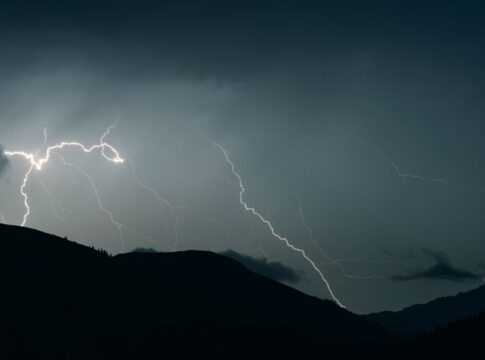
Clouds reveal atmospheric conditions unfolding thousands of feet above your head. Cumulus clouds—those puffy, cotton-like formations with flat bases—indicate fair weather when they remain small and scattered. These clouds typically form at altitudes between 3,000 and 6,500 feet and dissipate by evening. When cumulus clouds begin stacking vertically, however, reaching heights exceeding 20,000 feet, they transform into cumulonimbus thunderheads capable of producing lightning, hail, and dangerous downdrafts within 30 to 60 minutes.
Cirrus clouds, the wispy, feather-like formations at altitudes above 20,000 feet, consist entirely of ice crystals. Their appearance marks the leading edge of a warm front, where warm air rides up and over a retreating mass of cold air. As the front approaches over the next day or two, these high clouds thicken into cirrostratus, creating that characteristic halo effect around the sun or moon. The sequence continues as clouds lower and thicken into altostratus, then nimbostratus—the thick, gray blanket that finally delivers sustained precipitation.
Stratocumulus clouds present as low, lumpy gray layers, often covering the entire sky. While they look threatening, these clouds rarely produce more than light drizzle because they lack the vertical development needed for significant precipitation. The key distinction: clouds with vertical growth bring severe weather, while horizontally layered clouds typically indicate stable, albeit potentially dreary, conditions.
Wind Direction and Atmospheric Pressure Systems
In the Northern Hemisphere, wind circulates counterclockwise around low-pressure systems and clockwise around high-pressure systems due to the Coriolis effect. When you stand with your back to the wind, the low-pressure center—where storms develop—lies to your left and slightly ahead. This relationship, discovered by Dutch meteorologist Christophorus Buys Ballot in 1857, remains a fundamental principle for predicting weather movement.
Backing winds, which shift counterclockwise over time—from east to north to west, for example—indicate an approaching low-pressure system moving toward your location. Veering winds, rotating clockwise from east to south to west, suggest a high-pressure system is approaching or a low-pressure system is moving away. A sudden wind shift from southwest to northwest, often accompanied by a temperature drop of 10 to 20 degrees Fahrenheit within an hour, signals a cold front’s passage.
Wind speed acceleration throughout the day, particularly when accompanied by increasing cloud cover, indicates strengthening low pressure and likely precipitation. Conversely, wind that dies down at sunset under clear skies suggests stable high pressure will persist. Sustained winds exceeding 15 miles per hour make precipitation more likely because they indicate stronger pressure gradients and more active atmospheric mixing.
Optical Phenomena and Moisture Content
The famous “red sky at night, sailor’s delight; red sky at morning, sailor take warning” adage works because weather systems in temperate latitudes generally move from west to east. During sunset, red light—which has the longest wavelength in the visible spectrum—penetrates farther through the atmosphere than shorter blue wavelengths. When you see red skies at sunset, you’re viewing sunlight passing through dry air to your west, suggesting clear conditions are moving toward you. Red skies at dawn indicate that clear, dry air has already passed to your east, while moisture-laden systems approach from the west.
Halos around the sun or moon form when light refracts through hexagonal ice crystals in cirrostratus clouds at a precise 22-degree angle. Because these clouds precede warm fronts by 18 to 36 hours, the appearance of a halo serves as a reliable precipitation predictor. A larger, 46-degree halo, though rarer, forms through a different crystal face and indicates the same atmospheric conditions. The saying “ring around the moon, rain real soon” reflects centuries of accurate weather observation compressed into memorable verse.
Dew formation overnight indicates clear skies, light winds, and high relative humidity near the ground—conditions associated with high pressure and continued fair weather. The absence of dew on clear, calm nights suggests low humidity and potentially approaching dry air behind a passing front. Heavy morning dew followed by rapid evaporation and cumulus cloud formation by mid-morning can signal afternoon thunderstorm development, especially during warm, humid summer months.
Barometric Pressure Without Instruments
While modern altimeters and barometers provide precise pressure readings, your body and surroundings offer crude but useful pressure indicators. Smoke rising vertically from a campfire indicates high pressure and stable air, whereas smoke that flattens and spreads horizontally suggests low pressure and turbulent atmospheric conditions. This occurs because descending air in high-pressure systems suppresses vertical air movement, while rising air in low-pressure systems creates instability.
Sound travels farther and more clearly when low pressure dominates because humidity increases sound wave transmission. If distant sounds—train whistles, highway traffic, or aircraft—seem unusually loud and clear, atmospheric pressure is likely falling, and weather deterioration may follow within 12 to 24 hours. High pressure, conversely, tends to trap sound closer to its source.
Joint pain and headaches that correlate with weather changes occur because rapid pressure drops of 0.10 inches of mercury or more cause tissues to expand slightly. A study published in the journal Pain Medicine in 2014 found that 67% of participants with chronic pain conditions could accurately sense pressure changes before storms, making humans themselves remarkably sensitive barometers.
Animal Behavior and Weather Prediction
Birds fly lower before storms because falling barometric pressure affects their ears and sinuses, making high-altitude flight uncomfortable. Additionally, insects—their primary food source—fly closer to the ground in low pressure and high humidity. Swallows and swifts swooping low over fields or water bodies often indicate precipitation within six to twelve hours. Conversely, birds soaring at high altitudes suggest stable high pressure and continued fair conditions.
Cattle and horses instinctively turn their backs to approaching weather systems and often seek shelter 12 to 24 hours before storm arrival. Ranchers in the Great Plains have relied on this behavior for generations, particularly before tornadoes. Deer and elk feeding patterns also shift before weather changes, with increased activity before storms as they build energy reserves for the period when they’ll shelter in place.
Ants build higher mounds and reinforce entrances when they sense prolonged rain approaching, typically three to five days in advance. This behavior results from their sensitivity to humidity changes and barometric pressure variations. While not perfectly reliable, observing multiple animal behaviors simultaneously—birds flying low, livestock seeking shelter, and increased ant activity—provides stronger evidence of approaching weather systems than any single indicator.
Temperature and Humidity Observations
The relationship between temperature and dew point reveals precipitation potential. When air temperature and dew point converge to within three degrees Fahrenheit, relative humidity exceeds 85%, and fog, low clouds, or precipitation becomes likely. You can estimate dew point without instruments by observing when dew forms on grass in the evening—this temperature represents the dew point at ground level.
Temperature inversions, where warmer air sits atop cooler surface air, trap moisture, pollutants, and sound near the ground. These conditions create morning fog in valleys and make distant sounds remarkably clear. Inversions typically occur under high pressure with light winds and clear skies, indicating continued stable weather. The inversion breaks as surface heating throughout the morning allows air to mix vertically again.
Rapid temperature drops of 15 degrees Fahrenheit or more within one to two hours indicate a strong cold front passage. These dramatic changes often accompany wind shifts from southwest to northwest and a pressure rise of 0.10 to 0.20 inches of mercury. Understanding that cold fronts move at average speeds of 20 to 35 miles per hour helps you estimate when conditions will stabilize after the front passes your location.
Frequently Asked Questions
How accurate are natural weather prediction methods compared to professional forecasts?
Experienced observers using multiple natural indicators can predict weather changes within 12 to 24 hours with 65-75% accuracy, according to National Weather Service studies. Professional forecasts exceed 90% accuracy for the same timeframe but become less reliable beyond three days, making natural observation valuable for immediate decision-making in remote areas.
What single weather indicator provides the most reliable predictions?
Barometric pressure trends offer the most reliable single indicator, with falling pressure predicting deteriorating conditions and rising pressure indicating improvement. When using natural observation, combining wind direction changes with cloud sequence patterns provides the highest accuracy—approaching 80% for 12-hour forecasts when both indicators align.
Can you predict tornado conditions without instruments or forecasts?
Specific signs include a greenish or yellow sky tint caused by light scattering through hail-laden clouds, sudden wind shifts, large hail, and an ominous silence as winds briefly cease before the tornado. The distinctive roaring sound, often compared to a freight train, provides final confirmation but leaves minimal response time—typically 30 seconds to two minutes.
How do coastal and mountain environments affect natural weather prediction?
Coastal areas experience sea breezes that complicate wind direction interpretation, while mountains create localized weather through orographic lifting, where air forced upward cools and produces precipitation on windward slopes. In mountainous terrain, observe clouds forming at peak level—caps or lenticular formations indicate strong upper-level winds and potential storm development within 12 to 24 hours.
Key Takeaways
- Cloud sequences reveal approaching weather systems: high cirrus clouds thickening and lowering over 24-48 hours indicate precipitation, while vertically developing cumulus clouds warn of possible thunderstorms within one hour.
- Wind direction matters more than speed: backing winds (counterclockwise shift) signal approaching low pressure and storms, while veering winds (clockwise shift) indicate improving conditions.
- Combine multiple indicators for accuracy: observing pressure trends, cloud patterns, wind direction, and animal behavior simultaneously yields 70-80% prediction accuracy for the next 12-24 hours.
- Optical phenomena provide reliable warnings: halos around the sun or moon predict precipitation within 18-36 hours, while red morning skies indicate moisture approaching from the west with 75-80% reliability.