
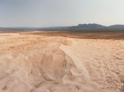
The Truth About Deserts Covering One Third of Earth’s Land
By Trivia Daily, Geography Desk — Published October 12, 2026
Table of Contents
- Key Takeaways
- The Truth Deserts Covering Our Planet Tell About Climate
- How Deserts Shape Countries and Borders
- Desert Types Across the World
- Landmarks and Natural Wonders in Desert Regions
- The Expanding Truth About Desert Coverage
- Frequently Asked Questions
When you picture a desert, endless golden sand dunes probably come to mind. But the truth about deserts covering roughly one third of our planet’s land surface reveals a far more complex story. These arid regions span every continent except Europe, ranging from scorching hot wastelands to frozen polar expanses. What truly defines a desert isn’t heat or sand—it’s the absence of water. Any region receiving less than ten inches of precipitation annually qualifies, which means the icy Antarctic counts as the world’s largest desert, not the Sahara.
This geographic reality shapes countries, borders, and entire civilizations. Deserts influence where cities rise, how rivers flow, and why certain landmarks become legendary. Understanding these places means rethinking everything you thought you knew about dry lands.
Key Takeaways
- Deserts cover approximately 33% of Earth’s land surface, spanning all continents except Europe
- Antarctica is technically the world’s largest desert due to extremely low precipitation, not temperature
- The Sahara Desert alone is nearly as large as the entire United States or China
- Only about 20% of Earth’s deserts are covered in sand; most are rock, gravel, or ice
- Desert regions are expanding through desertification, affecting countries on multiple continents
- Some deserts, like the Atacama in Chile, receive less than one millimeter of rain per year
The Truth Deserts Covering Our Planet Tell About Climate
Deserts aren’t random geographic accidents. They form through specific atmospheric and geographic conditions that create moisture-starved environments. Subtropical deserts like the Sahara and Australian Outback sit beneath high-pressure zones where descending air masses prevent cloud formation. Rain shadow deserts form when mountain ranges block moisture-laden winds—the Mojave Desert exists because the Sierra Nevada mountains intercept Pacific Ocean storms before they reach inland areas.
Coastal deserts present a fascinating paradox. The Atacama Desert in Chile borders the Pacific Ocean yet ranks among Earth’s driest places. Cold ocean currents create temperature inversions that trap moisture as fog rather than allowing it to fall as rain. The Namib Desert in southwestern Africa operates on similar principles, receiving ocean fog but almost no rainfall.
Cold deserts challenge popular assumptions entirely. The Gobi Desert in Mongolia and China experiences freezing winters with temperatures plunging below negative forty degrees Fahrenheit. Antarctica receives so little precipitation—less than two inches annually in interior regions—that it qualifies as a desert despite being covered in ice miles thick. These polar deserts remind us that aridity, not heat, defines desert geography.
How Deserts Shape Countries and Borders
Desert geography profoundly influences political maps. The Sahara Desert effectively divides North Africa from sub-Saharan Africa, creating distinct cultural and economic zones. Countries like Egypt concentrate their populations along the Nile River, with over 95% of Egyptians living on just 5% of the land. The vast Empty Quarter (Rub’ al Khali) spans portions of Saudi Arabia, Oman, Yemen, and the United Arab Emirates, with borders drawn through largely uninhabited sand seas.
Australia presents a striking example of desert dominance. Arid and semi-arid lands cover roughly 70% of the continent, pushing the population toward coastal cities. The interior remains sparsely inhabited, with famous landmarks like Uluru (Ayers Rock) standing in regions where water scarcity limits settlement. This distribution creates one of the world’s most urbanized populations despite having enormous land area.
Desert borders often follow natural features—dry riverbeds, mountain ranges, or simply straight lines drawn across emptiness. The border between Libya and Chad, for instance, runs straight through the Sahara for hundreds of miles, a legacy of colonial mapmaking that paid little attention to the desert’s subtle geographic variations.
Desert Types Across the World
| Desert Type | Formation Cause | Major Examples | Key Characteristics |
|---|---|---|---|
| Subtropical | High-pressure zones | Sahara, Arabian, Kalahari | Extreme heat, sand dunes, sparse vegetation |
| Rain Shadow | Mountain barriers | Mojave, Patagonian, Great Basin | Blocked moisture, varied temperatures |
| Coastal | Cold ocean currents | Atacama, Namib | Fog, minimal rain, moderate temperatures |
| Cold/Polar | Low temperatures prevent moisture | Antarctica, Arctic, Gobi | Freezing conditions, ice or frozen ground |
Landmarks and Natural Wonders in Desert Regions
Deserts host some of Earth’s most iconic landmarks. The Grand Canyon, carved by the Colorado River through Arizona’s desert landscape, reveals two billion years of geological history in its layered rock walls. Death Valley in California holds the record for the hottest air temperature reliably recorded on Earth—134 degrees Fahrenheit in July 1913.
Natural wonders emerge from desert conditions. White Sands in New Mexico features pure gypsum dunes that gleam brilliantly white. The Painted Desert in Arizona displays layers of sedimentary rock in vivid reds, oranges, and purples. These formations exist because limited vegetation and rainfall allow geological features to remain exposed rather than hidden beneath soil and plant cover.
Desert oases create concentrated ecosystems where underground water reaches the surface. These rare water sources supported ancient trade routes across the Sahara and Arabian deserts, becoming crucial landmarks for navigation and survival. Cities like Damascus in Syria and Timbuktu in Mali grew around such water sources, becoming cultural and commercial centers.
The Expanding Truth About Desert Coverage
Deserts aren’t static. Desertification—the process of fertile land becoming desert—affects countries worldwide. The Sahara has expanded southward over recent decades, threatening agricultural lands in the Sahel region. Overgrazing, deforestation, and changing climate patterns accelerate this process.
The Aral Sea, once among the world’s largest lakes, has shrunk dramatically since the 1960s due to irrigation projects diverting inflowing rivers. The exposed lakebed now forms a new desert in Central Asia, complete with salt flats and dust storms. This human-caused desertification demonstrates how quickly landscapes can transform.
Some regions fight back. China’s Green Wall project attempts to halt the Gobi Desert’s expansion through massive tree-planting efforts. Success remains mixed, but the attempt shows how desert boundaries can shift both ways under the right conditions.
Frequently Asked Questions
What is the largest desert in the world?
Antarctica is the world’s largest desert, covering about 5.5 million square miles. Though covered in ice, it receives extremely little precipitation, meeting the technical definition of a desert. The Sahara is the largest hot desert at approximately 3.6 million square miles.
Do all deserts have sand dunes?
No, only about 20% of desert surfaces are covered in sand. Most deserts consist of bare rock, gravel plains, or in the case of cold deserts, ice. Sand dunes form only where wind and sand supply conditions align properly.
Which continent has no deserts?
Europe is the only continent without true desert regions. While some areas of Spain and other Mediterranean countries experience dry conditions, none meet the technical precipitation threshold that defines a desert.
Can deserts support human populations?
Yes, millions of people live in desert regions worldwide. Cities like Phoenix, Las Vegas, Dubai, and Cairo thrive in desert environments through water management, technology, and trade. However, most desert regions remain sparsely populated compared to temperate zones.
The next time you look at a world map, remember that the empty spaces aren’t really empty. Those vast desert regions covering a third of our continents contain geological marvels, support unique ecosystems, and tell the story of how water—or its absence—shapes everything from borders to civilizations. Some of Earth’s most extreme places turn out to be far stranger and more varied than simple sand and heat.